Punta Brava Lighthouse
Punta Brava Lighthouse, also known as Punta Carretas Lighthouse, is a lighthouse in Punta Carretas, Montevideo, Uruguay. It was erected in 1876. The lighthouse has a height of 21 metres and its light reaches 15 nautical miles away, with a flash every ten seconds.Photo: Diode, CC BY-SA 3.0.
Photo: Wikimedia, CC BY-SA 3.0.
Notable Places in the Area
Museo Zorrilla
Museum

Photo: Fadesga, CC BY-SA 3.0.
Museo Zorrilla is a museum situated 1 km north of Punta Brava Lighthouse.
Punta Carretas Shopping
Shopping center

Photo: Pedro Felipe, CC BY-SA 4.0.
Punta Carretas Shopping is a shopping mall of Montevideo, Uruguay. Punta Carretas Shopping is situated 1¼ km north of Punta Brava Lighthouse.
Localities in the Area
Punta Carretas
Suburb
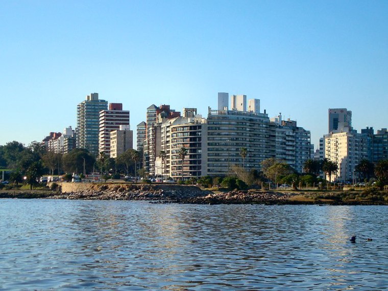
Photo: Hoverfish, CC BY-SA 3.0.
Punta Carretas is a barrio of Montevideo, Uruguay. Politically located in the CH Municipality, it is an affluent neighborhood, with a high population density and a large number of high-rise apartment buildings.
Barrio Jardin
Neighborhood

Photo: Hoverfish, CC BY-SA 3.0.
Barrio Jardín is a small neighbourhood of Montevideo, Uruguay, which is part of Barrio Parque Rodó. Barrio Jardin is situated 2½ km north of Punta Brava Lighthouse.
Pocitos
Suburb

Photo: Shant, CC BY-SA 2.5.
Pocitos is an upscale seaside barrio of Montevideo, Uruguay. Pocitos is situated 3 km north of Punta Brava Lighthouse.
Punta Brava Lighthouse
- Type: Lighthouse
- Description: lighthouse in Uruguay
- Categories: tourist attraction and tourism
- Location: Municipio Ch, Montevideo Department, Uruguay, South America
- View on OpenStreetMap
Latitude
-34.93524° or 34° 56' 7" southLongitude
-56.16045° or 56° 9' 38" westElevation
3 metres (10 feet)Open Location Code
48Q53R7Q+WRGeoNames ID
7303807Wikidata ID
Q7260513Punta Brava Lighthouse Satellite Map
© OpenStreetMap, Mapbox and Maxar
Also Known As
- Croatian: Svjetionik Punta Brava
- English: Faro de Punta Brava
- English: Punta Carretas Lighthouse
- French: Phare de Punta Brava
- French: phare de Punta Brava
- German: Faro de Punta Brava
- Spanish: Faro de Punta Brava
- Spanish: Faro de Punta Carretas
- Swedish: Faro de Punta Brava
Localities in the Area
- Parque RodóSuburb, 3 km north
- PalermoSuburb, 3 km northwest
- CordónLocality, 3½ km north
- Pocitos NuevoLocality, 3½ km northeast
- Barrio SurSuburb, 4 km northwest
Places in the Area
- Edificio Bel HorizonApartment building, 720 metres north
- Edificio Torres del Nuevo MundoApartment building, 730 metres north
- Edificio TabareBuilding, 1 km north
- Club Aleman de Remo (Sede Social)Building, 1 km north
- Torre Green FieldBuilding, 1 km north
Popular Destinations in Uruguay
Discover Montevideo, Colonia, Salto and Paysandú.
Escape to a Random Place
Discover other destinations in the world.
About Mapcarta. Thanks to Mapbox for providing amazing maps. Text is available under the CC BY-SA 4.0 license, excluding photos, directions and the map. Description text is based on the Wikipdia page Punta Brava Lighthouse. Photo: Diode, CC BY-SA 3.0.